It’s high time that I posted about the field work I’ve been doing lately. Before I became sick last week, I was out mapping the newest lava flows at Waikupanaha. Well, it was a gorgeous day and I did manage to snap a few pictures before the hospital called.

While hiking to where we were to begin our mapping, we heard and saw some lava bubble bursts to the left of the ocean entry plume. Unfortunately, a watched pot never boils and neither does a watched ocean entry. As soon as I pulled my camera out, the bursts stopped. Ah well, at least the ocean entry plume still looked good.

This is a view to the south, and you can see the pali (or cliff) at the right of the frame. The lava flows toward the ocean from very far up the pali, sometimes aboveground and mostly underground through lava tubes.
The way we map new lava breakouts is by putting handheld GPS units on Tracking mode and then walking along the boundaries of the fresh lava. It’s a good way to map, since you can set the GPS to record your position at intervals of three seconds. The level of accuracy is enough for our purposes. After all, the flow field changes fairly often.
Moving on to the field work I did on Friday (it wasn’t too strenuous, don’t worry)! We met up with a cultural resources guy from Pohakuloa Training Area, a massive area between Mauna Loa and Mauna Kea where the Army and Marines practice bombing and combat. The samples we needed to obtain were on the military’s land, so we have to go through the proper channels to collect them.
There’s a bit of archaeology in what we were doing there.

That is a pit dug by the ancient Hawaiians. No one is sure why they dug these pits, which happen to be about 9,000 feet up the slope of Mauna Loa. We collected samples of the displaced rocks to perform the same Chlorine-36 cosmogenic isotope dating that we did on Mauna Loa’s summit. The reddish lava flow that the pits are situated in is of unknown age, so we’re also going to date that as well. It should give us an idea of how long ago the Hawaiians made the pits.
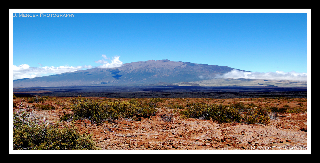
I suppose it can’t hurt to throw in a picture of the other massive volcano on this island. If you can make out a small whitish blob in the left foreground, past the plants…that’s our truck. This might give some sense of how gentle this particular slope of Mauna Loa is. Trust me, they’re not all like that!
Tonight is my last night housesitting, so my internet access (and consequently posting) should pick up a bit this week.
