Welcome (back) to Paradise!

12 08 2009

Hello and welcome to the 2nd edition of VolcanoSummer – Hawai`i! This year brings a much shorter visit to the Big Island and a somewhat familiar agenda, with exciting new faces and places added for your viewing pleasure. I arrived in Hilo via Honolulu on Sunday and was promptly met by the excellent Dr. Mark Kurz of the Woods Hole Oceanographic Institute and his nephew, David Kurz. We acquired the soon-to-be Dr. Brent Goehring of the Lamont-Doherty Earth Observatory and made the familiar trek up to Volcano, Hawai`i. This is the town outside of Hawai`i Volcanoes National Park, where our research group has rented two lovely houses for the duration of our expedition. We settled in to discuss the trip and await the arrival of the remaining members of our science party, Dr. Joe Licciardi of the University of New Hampshire and Shasta Marrero and Michelle Hinz of New Mexico Tech. Check out our awesome group!

CRONUS-HI09 Group

Our group was assembled to perform calibration work for the CRONUS-Earth Project using Mauna Loa lava flows. CRONUS is an international effort by geoscientists to use cosmogenic isotopes in dating many types of geologic features around the world. You may be scratching your head and wondering what the heck a cosmogenic isotope is, so I’ll give you the short version. The sun continually bombards the Earth with cosmic rays, and when some of these rays strike the ground they interact with certain elements contained in the rock. These interactions cause the elements to change into a slightly different version of themselves known as an isotope. You may be familiar with the concept of Carbon-14 dating, where scientists employ analysis of an isotope of carbon in order to date how old something is. CRONUS uses similar concepts but with rocks instead of carbon-based samples.

We are here in Hawai`i as part of an effort to determine just how accurate cosmogenic isotope dating methods can be. We are sampling lava from flows that we already know the ages of, whether through Carbon-14 dating of burned plant material (charcoal) or from historical accounts. The samples will be sent to laboratories for analysis, and we’ll be able to clearly see how accurate this dating method is. The benefit of cosmogenic isotope dating is that we are not limited as severely as we are with Carbon-14, and much older ages may be obtained. Basically, I’m hanging out with a bunch of geochemists who are into travelling the world and ascertaining the ages of various geologic features such as lava flows and landslides. It’s all in the name of science!

Ok, so that’s the detailed stuff. Let’s move on to the part you’ve all been waiting for: pictures!

Lava Ball the First

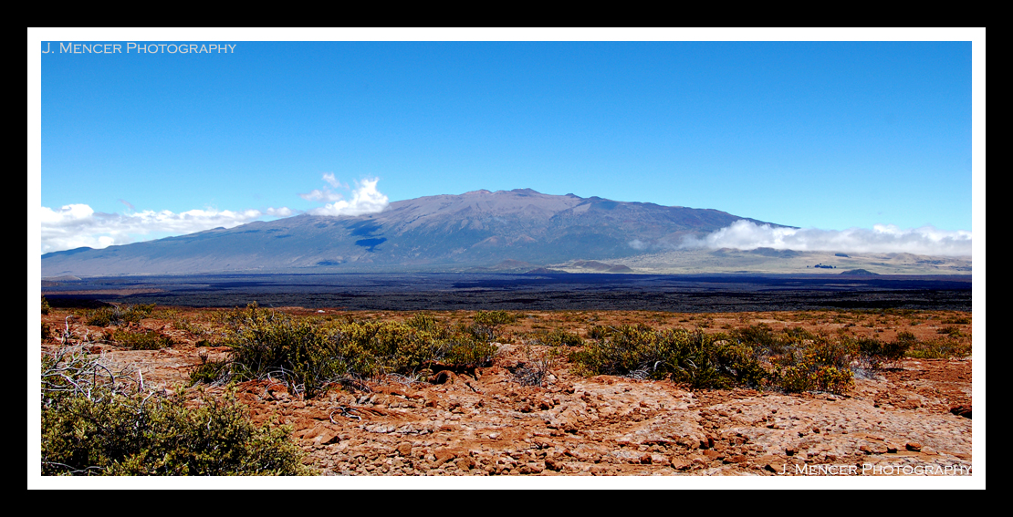
In this photo Mark, Brent, and Shasta are debating the merits of sampling from this particular lava ball. They’re standing on a roughly 900 year old Mauna Loa a`a lava flow. Site selection is key to our undertaking, as anything that could shield the rocks from the cosmic rays will throw off the dating technique. Also, the surface that is selected for sampling has to be the rock’s original surface. Erosion wears rocks down, and that type of material loss would make the rock appear younger than it actually is since the sun’s rays would have bombarded the eroded surface for less time. Scientists also like to use site selection as a means to argue amongst themselves. (No scientists were harmed in the making of that joke, FYI.) In the foreground of the picture you’ll find a 6lb sledgehammer, which can be used for sample collection or warding off greedy competing scientists. In the back right of the picture you can see Kilauea’s summit plume, which repeat readers may remember from last year. The summit eruption is indeed still going, in case anyone was wondering.

Plume Backwards

Hurricane Felicia never materialized by HVO, but the typical tradewinds were affected enough to cause the plume to blow in the direction opposite its normal route. Seeing the plume is like having a giant (and intensely awesome) welcome mat rolled out in greeting. The vent has increased substantially in size since I left HVO last September, and it now spans approximately 130 meters. To put it in perspective, that’s larger than a football field. Amazing.

I’m about to fall asleep while typing, so this’ll conclude tonight’s post.

P.S. – It’s great to be back!


From lava to the stars.

9 09 2008

We made a pretty stunning discovery in Halema`uma`u on Friday. Many months after the explosion that first opened the vent, we finally had visual confirmation of a roiling, active lava lake inside. Some of the scientists were over the vent in a helicopter, and they were able to get pictures and video of the lava. The best estimate is that it’s about 100 meters below the top of the vent. A few hours after the helicopter overflight, I went out with the gas geochemistry team to do Fourier transform infrared spectroscopy, or FTIR since the lava was visible.

The round part on top of the tripod is a telescope, and the box on top is the spectrometer. Anyway, since we were on the rim and right over the vent, I think perhaps a picture of the lava’s incandescence is in order.

Yep, that’s lava down there. That sort of glow just doesn’t normally happen during daylight hours. It was truly impressive to stand right above a lava lake. The noises were loud, tremendous, and unrelenting. If it wasn’t clanging with rock falls, it was making gas-rushing noises that sounded like jet engines. The earth is alive!

I have a special treat for all of you. My colleague Brian White was down on the other side of the vent from where I was, and he recorded video. You can finally hear the noises I keep writing about! Make sure your sound is turned on. It’s possible to see some of the incandescence as well.

Thanks Brian!

Saturday brought more impressive sights. I ventured up Mauna Kea with some colleagues to check out the view and do some stargazing. The name Mauna Kea means White Mountain, and that’s because it frequently has snow on its peak during winter. It stands 13,796 feet above the ocean, and is older than Mauna Loa and Kilauea. Mauna Kea is considered dormant, but not extinct. It’s also home to some of the world’s best telescopes and astronomical observatories.

Those are the Keck Twins, formally known as the W.M. Keck Observatory. They sit 85 meters apart at Mauna Kea’s summit and they each have a 10 meter primary mirror.

Those are cinder cones on the north flank of Mauna Kea. Since the volcano is in its “post-shield building” stage, it is literally pockmarked with cones like these.

This is the NASA Infrared Telescope Facility. It was posing nicely for me. It was built to support the Voyager missions.

This is the Caltech Submillimeter Observatory with its dome open.

I don’t think that one needs much explanation.

Here we have the moon, some stars, and the Subaru Telescope.

Last but certainly not least, I give you this:

Yes, that’s a laser issuing from one of the Keck Twins. It actually creates an artificial star that astronomers use to establish a relative location in the sky. I’m sure it does some other neat things, too, but I’m not aware of what they are, exactly. ***EDIT*** Check out Andrew Cooper’s comment at the end of this post for the actual use of the artificial star. He knows what he’s talking about!

If you’re ever in Hawai`i, sunset on Mauna Kea is definitely in order. Oh yeah…you might want to check out any available lava lakes, too.


It’s work time…field work, that is.

26 08 2008

It’s high time that I posted about the field work I’ve been doing lately. Before I became sick last week, I was out mapping the newest lava flows at Waikupanaha. Well, it was a gorgeous day and I did manage to snap a few pictures before the hospital called.

While hiking to where we were to begin our mapping, we heard and saw some lava bubble bursts to the left of the ocean entry plume. Unfortunately, a watched pot never boils and neither does a watched ocean entry. As soon as I pulled my camera out, the bursts stopped. Ah well, at least the ocean entry plume still looked good.

This is a view to the south, and you can see the pali (or cliff) at the right of the frame. The lava flows toward the ocean from very far up the pali, sometimes aboveground and mostly underground through lava tubes.

The way we map new lava breakouts is by putting handheld GPS units on Tracking mode and then walking along the boundaries of the fresh lava. It’s a good way to map, since you can set the GPS to record your position at intervals of three seconds. The level of accuracy is enough for our purposes. After all, the flow field changes fairly often.

Moving on to the field work I did on Friday (it wasn’t too strenuous, don’t worry)! We met up with a cultural resources guy from Pohakuloa Training Area, a massive area between Mauna Loa and Mauna Kea where the Army and Marines practice bombing and combat. The samples we needed to obtain were on the military’s land, so we have to go through the proper channels to collect them.

There’s a bit of archaeology in what we were doing there.

That is a pit dug by the ancient Hawaiians. No one is sure why they dug these pits, which happen to be about 9,000 feet up the slope of Mauna Loa. We collected samples of the displaced rocks to perform the same Chlorine-36 cosmogenic isotope dating that we did on Mauna Loa’s summit. The reddish lava flow that the pits are situated in is of unknown age, so we’re also going to date that as well. It should give us an idea of how long ago the Hawaiians made the pits.

I suppose it can’t hurt to throw in a picture of the other massive volcano on this island. If you can make out a small whitish blob in the left foreground, past the plants…that’s our truck. This might give some sense of how gentle this particular slope of Mauna Loa is. Trust me, they’re not all like that!

Tonight is my last night housesitting, so my internet access (and consequently posting) should pick up a bit this week.


Sorry for the interruption!

22 08 2008

So dear readers, I must beg your apologies. Last week I was out in the field almost every day, and then I had a trip to the hospital. The diagnosis was inconclusive, somewhere between a kidney infection and appendicitis. After a night in the Hilo hospital I was itching to get back up to HVO. I am now full of antibiotics and slightly worse for the wear, but I’m going back out in the field tomorrow! It’s a light field day, so I won’t have much chance to strain myself. It is pretty cool to go into an emergency room right after you’ve been mapping lava flows. The ER staff is a bit more impressed than they would be otherwise. Still, I don’t recommend spending your time in Hawai`i surrounded my medical professionals (unless you’re here for a conference, of course).

Ok, so here’s the amazing truck I drive for work. It’s my boss’ truck, and it has rock-crawling tires for jaunts up Mauna Loa. The front bumper has been sawed off for better clearance, too. It’s a beast.

I planned and am about one third of the way through conducting a survey of the gravity of the Ninole Hills in Kahuku Ranch on Mauna Loa’s Southwest Rift Zone. There is a gravity anomaly there that could indicate the presence of an older, proto-Mauna Loa that has since been overtaken by the new Mauna Loa. It was my boss’ idea of course, but it’s really amazing to be conducting the survey with very minimal supervision.

Over the weekend one of my entomologist friends was able to get the two of us into the Keauhou Bird Conservation Center, a normally off-limits endangered bird conservation facility. Our goal was to see the Alala, or Hawaiian Crow. There are only 60 of these birds left alive in the entire world, and they are all in captivity. Breeding them is exceptionally difficult as their genetic diversity is very limited. The females have notoriously poor egg quality, and they just don’t have the survival wherewithal to make it in the wild any longer. This is probably the most rare creature I’ve ever laid eyes on, and I won’t forget the experience any time soon.

The Conservation Center has two Alalas together in the educational aviary, and they’re not a breeding pair. The male has cataracts and the female has a degenerative ovary disease. They were still beautiful and obviously intelligent birds. The female has her left leg banded and the male’s right leg is banded.

She was enjoying a thawed mouse snack, and from the way she ripped into it her wild heritage was clearly evident.

This is the male, and he barely stayed still long enough for me to snap this picture.

At any rate, there will be more geology this weekend! It’s good to be back. A special note to Sherry and Randy from FL: I hope you didn’t miss the entries too much!


This is my job?!

5 08 2008

Last Wednesday we went down to the southern part of the island to collect littoral cone deposits. My boss is collaborating with a University of Massachusetts-Amherst professor to prove the magmatic origin of these littoral cones. Essentially, there is a large amount of olivine in the deposits closer to the coastline. The lavas that have erupted near Mauna Loa’s summit are olivine-poor. There are different hypotheses about why this is, and we were sampling to test the different ideas. On with it, right?

Well, we off-roaded for about an hour after we left the highway. When we tumbled out of the truck, this is the view that greeted us.

Very, very nice. After a few minutes of wistful gazing, we headed off to find our littoral prey.

This section of the island has littoral cones all along the shoreline. They’re the distant hills in that picture. Here is a closer view.

We had to climb the cones, find likely samples, break them open with a rock hammer, see if they were glassy and non-stratified enough, and then fill a whole bag with similar samples. Essentially, I spent the day smashing rocks with a hammer. It’s really a fun activity!

Our lunch break afforded me the opportunity to take a few pictures. You need to click the last one to appreciate it fully.

To say the waves were stunning would be an understatement. Eating lunch on a beach while trying to scrape basalt chunks out from under my fingernails has to be one of the best ways to enjoy a sandwich I’ve ever attempted.

We collected samples from 6 littoral cones and then headed back to HVO. On the way we stopped by some petroglyphs and I was able to get a shot.

Sometimes I still can’t believe I’m a geologist. It’s incredibly hard work, but worth every second. I remind myself of that when I feel like whining about doing something difficult. Hard work does have its rewards, and that’s why I’m working my butt off here in paradise.


Highly educational

28 07 2008

After last week’s intense office work, I was dying to get back in the field. Since my knee wasn’t cleared until Saturday, my field experiences would have to be tame. Still, that doesn’t mean they were boring! Since there are a good number of pictures, I’m going to break things up into Thursday and Friday. Tonight’s post will cover last Thursday.

My boss organized a field trip for anyone interested to Kona’s Gold Coast. 13 of us set out from HVO early Thursday to begin a day of learning in the best way possible – while standing in front of the subjects of our study! The first stop was Rainbow Falls outside of Hilo.

While the average tourist might have stopped here to marvel at the falls themselves (and the tiny rainbow you can just glimpse at their base), we were here to look at the volcanic stratigraphy. Behind the mist of the falls it’s possible to glimpse columnar basalt. Lava flows of several different ages are visible here.

The next stop was at Kaumana Cave, a well-known skylight in a massive lava tube created by the 1881 eruption of Mauna Loa. The tube is about 25 miles long, and definitely illustrates the hazards posed by lava flows. The guy at the bottom of the picture is a visiting scientist from Japan, and the guy on top of the tube is one of our preeminent seismologists.

While stopped at a kipuka for some geologic question and answer time, I spotted this plant that was reveling in the morning dew. Just thought you might like some Hawaiian foliage to brighten your day! If any of you biologically-inclined sorts know what kind of plant this is, do tell.

This is an incredibly interesting thing to geologists. It’s called a xenolith, which translates from Latin as “foreign rock.” That’s exactly what it is. This particular xenolith is dunite, a rock that is composed of coarse grains of olivine and originates in the earth’s crust. Essentially, the basalt grabbed the piece of dunite from where it formed deep below the surface and carried it upward, where it came to rest inside the flow. This particular lava flow is one of the best sources of xenoliths in the entire world. It is from Hualalai volcano, and the eruption took place in 1800. There were plenty of other xenoliths nearby ranging from clinopyroxene to gabbro and more. This is amazingly interesting for someone who is captivated by crust-eruption interactions (yeah, that would be me).

Our trip informed us in detail about Kilauea, Mauna Loa, Mauna Kea, and Hualalai. The only volcano we didn’t touch on was Kohala, the oldest one on the island. My boss is so knowledgeable on all things Hawai`i that it blows my mind. I know he was born and raised on the islands, and that he’s been working at HVO for over 20 years…but still! He’s brilliant. Here is where I ought to mention that he’s the scientist who proved that Kilauea volcano has a deep plumbing system. This is critical to our understanding of the volcano’s eruptions. This is such an amazing opportunity.

After our long day of learning, we headed down to Mauna Loa’s 1881 lava flow on the western portion of the island. The flow took 8 days to reach the coast, and reach the coast it did. It travelled over 31 miles, and this is how it looks today.

Not too shabby, is it? The grass is a pretty nasty invasive species and is resistant to fire. Eradicating it is nearly impossible, but at least it makes the pictures look good. We ended the educational portion of our trip at Anaehoomalu Bay (known as A Bay by people who don’t want to attempt THAT tongue-twister). You can just look at the water and guess what we did when we got there. I’m not going to give away all of our secrets.

Tomorrow will be pictures and talk about Friday’s gravity survey. This Thursday I’m going to the southern end of the island to collect samples from littoral cone deposits on Mauna Loa’s Southwest Rift Zone. I’m ready and waiting for the fieldwork to begin anew!


Office work for the glory of science!

22 07 2008

Having an injury while in Hawai`i for a summer of outdoor research is definitely a drag. Even my meager plans to go snorkeling last weekend were derailed by rainstorms. My boss wouldn’t let me go to the ocean entry tonight because I’m not medically cleared until this Friday. ((Sigh))

To say that desk work is frustrating doesn’t begin to convey today’s small agonies. I’m attempting to georeference new and improved satellite photography for our mapping project. I am using a program called ArcGIS, and its offshoot known as ArcMap, to compare the old satellite imagery with the new. Unfortunately, the new images come to me as 1 kilometer squares with absolutely no reference points (aside from their topographic features). I have to place the new image over several older ones and then compare distinctive features to link the images up. Imagine trying to take two different tracings and line them up as closely as possible by stitching them together. It’s a very time-intensive job, since you have to look for the smallest recognizable features to stitch in order to make an accurate map.

I spent 5 hours working on one quadrant (Mauna Loa’s summit and the NOAA Weather Observatory on its flank). Guess what happened? Yes, the computer lost the data. 26 meticulously georeferenced points. 5 hours of beating the thing into submission, and all for naught. ARGH. I will conquer it tomorrow, I swear.

Here’s a sample of the type of images I’m working with. The Big Island is 10,432 square kilometers. Each image I work with is one kilometer. You can see how this would take quite a while.

Since I haven’t posted one of these before, this shows how much of the Big Island’s surface area is covered by its various volcanoes. Mauna Loa is huge, and covers 51% of the island. Remember that Hualalai, Mauna Loa, and Kilauea are the only 3 active volcanoes. Hualalai has been dormant for some time, and doesn’t have much eruptive capability left. Kilauea is always erupting (these days) and is the current star of the show. However, the amount of lava produced by Kilauea in one day was produced by Mauna Loa in 20 minutes in 1984. It’s far and away the most potentially dangerous volcano in Hawai`i.

Thankfully, we’re going on a field trip up Mauna Loa on Thursday. I am so excited to get out of the office it’s almost silly. The week after this one I’ll either be hacking through the low jungles of Mauna Loa’s eastern flank doing a gravity survey, or up on Mauna Loa’s summit doing more kinematic GPS. Down with office work!*

*Bear in mind that office work is also necessary for good science, and that the author of this post is just mildly stir-crazy.


`Ainapo Adventures

15 07 2008

At long last, the `Ainapo Trail story in pictures and words! Huzzah, and here we go.

The day started early and 5 of us headed up Mauna Loa’s northwest flank in my boss’ heavy duty truck.

Once we were near the summit, the helicopter met us and flew us across the caldera to the southeastern flank. My boss was already waiting for us, as the helicopter had taken him up first. We split into teams of 3 to perform our surveys. My group headed down the `Ainapo Trail, certain to camp overnight. The second group headed around Mokuaweoweo (Mauna Loa’s caldera) and was able to drive back down the same day.

Here’s the start of our survey. We were at the 3rd benchmark here, and we were just finishing up lunch. The day started off beautifully.

The good weather was not to remain our companion for long, however. This was the scene near our 5th or 6th benchmark. I have to say that I love my boss’ outfit. Like all good geologists, his style is impeccable. You’ve seen the way I dress in the field, so be aware that this is utterly tongue-in-cheek. Perhaps we should look into Nike sponsorship or something. At least then we’d match.

The fog was accompanied by rain, and we found our last benchmark of the day in a steady drizzle. Luckily for us, the bossman is resourceful and found a dry (albeit cramped) place to sleep for the night. In a lava tube. On the side of the world’s largest volcano. This has to be one of the highlights of my outdoor life, if not of my entire life.

My boss did a lovely job of modelling the tube for the camera. We had a simple dinner of minestrone heated over the tiny stove, and then we were about ready for sleep. Camping conversations are always fun, and ours was no exception. I’m not going to post a photo of my portion of the lava tube, as it was an even tighter fit than the one pictured. My parents do not need their respective blood pressures elevated any higher than necessary by my escapades.

I do have to say that one of the most rewarding parts of camping is the unexpected splendor of the early morning views that are often available. When you reach a campsite at night, the daylight can offer wonderful surprises. Shortly after dawn on Mauna Loa was no exception.

The plume from Kilauea’s Halema`uma`u vent is visible in the middle of the picture. It is situated at approximately 4,000 feet above sea level. Our campsite was about 9,000 feet above sea level. We started our hike around 13,000 feet above sea level. The temperature dropped to 42 degrees Farenheit in our lava tube, so we weren’t that uncomfortable. I slept poorly, but that could have been because my tube section was the size of a coffin. Most of the hike was over a`a lava, and that’s why I was so battered by the end.

The survey went well overall, and we’ll polish the data tomorrow. We should be able to compare this information with last year’s in order to assess Mauna Loa’s deformation rate. This, in turn, will enable us to form a better picture of the volcanic activity beneath the mountain’s massive surface.


Damage Report!

12 07 2008

I have returned safely from my `Ainapo Trail survey, and it is not an exaggeration to say that I am beat. Literally. It looks like I was in a fight. You think I’m kidding, but I’m not. The bottoms of both of my feet are covered in blisters. Each heel is covered by a blister. All of the available bottom surface of both big toes is consumed by blister. Several smaller toes are in on the action, and I have a few random blisters on the balls of both feet as well as sporadic, small blisters elsewhere. It is thoroughly disgusting and incredibly painful.

In addition to the blister invasion, I can’t really move my lower body. My pack weighed 43lbs, and when I was carrying the kGPS the weight totalled 61lbs. For reference, I weigh 130lbs with clothes on. If you are not a fan of math, that translates to about 47% of my body weight. As a result, I slipped and fell on a few occasions. Yesterday morning I managed a stunning kneeplant into some a`a lava, which as you hopefully recall is the pointy, unforgiving kind. Half of my left knee is swollen, all of it is bruised, and there are a few bloody spots to be found. My wounded knee (haha) decided to rebel early this morning and consequently made the rest of our epic journey fairly unpleasant. Walking on a normal surface would’ve been a challenge, and the windward side of Mauna Loa is anything but normal.

I am also the proud owner of eleven new bruises (that I can find without assistance), assorted scratches, and a plethora of achey body parts.

I love my life. Seriously.

Since I’m too pathetically sore to stand up and procure my camera from the foot of my bed, pictures and a description of the survey will have to wait. Also, there’s a small piece of basalt in my eye. This ought to annoy me, but how many people complain about lava chips from Mauna Loa invading personal eye space? I am going to appreciate this chip! Ok, I’m going to appreciate it for about 30 seconds and then get it out.

Here’s a video of the brand new eruption near Pu`u O`o to tide all of you over until I can write more.

The helicopter they were using to shoot the video? That’s the one I’ve ridden in twice now. I do the same sort of thing, except minus the video camera and over Mauna Loa instead. I’m hoping to get out to the active eruption site in the helo next week. Time to go nurse my battle wounds!


Whirlwind of kGPS excitement.

9 07 2008

I spent yesterday in the office sorting and cataloguing last week’s Cl-36 samples for X-ray fluorescence (XRF) analysis. It was a quiet and non-eventful day, so that’s why I didn’t write a new post. Today I was supposed to go to the floor of Kilauea’s caldera and learn how to do kinematic (moving) Global Positioning System (GPS) surveys. Unfortunately, that didn’t happen due to a timing error when it came to dodging red tape.

In order to go into Kilauea’s caldera, you have to wear a respirator and hard hat. This is due to the extremely high level of sulfur dioxide (SO2) gas that is issuing from the newest vent, Halema`uma`u. Because of the likelihood of lung damage from SO2 inhalation, the government requires that all new caldera researchers take a spirometer test. A record of your original, pre-caldera lung capacity is needed to compare against any possible future lung damage. I couldn’t get an appointment to visit the doctor in Hilo until Friday, so today’s caldera trip was cancelled.

The kinematic GPS (kGPS) tutorial was not, however. We visited several benchmarks outside of the caldera rim for training purposes. Here’s a geodetic survey benchmark, so you understand what we were looking for. These markers are small metal disks affixed firmly to the ground and their precise locations have been recorded before, sometimes many years ago. People who are into geocaching may be familiar with them already.

I required kGPS training because on Thursday I’m going to be part of a team that is being dropped off by helicopter on the eastern flank of Mauna Loa. Our mission is to hike down the `Ainapo Trail and record the benchmarks on the Mauna Loa level line. This will allow us to see if the volcano is deforming at all. Deformation can be a good indicator of volcanic activity beneath the earth’s surface. At any rate, the `Ainapo Trail is widely regarded as the most difficult hike in Hawai’i. Let’s just say that I’m pleased we’re carrying the equipment down and not up. We’ll be camping out somewhere on the trail on Thursday night, and we should return on Friday.

For now, here’s a picture of me with my kGPS from earlier today. That’s the summit of Kilauea, the world’s most active volcano.

Fun for all.

I suppose I ought to mention that there was an active volcanic eruption occurring behind me.

Good times.

That’s just pretty cool.